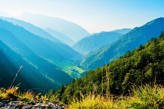
Mt. Tsukuba
An 877 meter tall mountain located in Tsukuba City, Ibaraki Prefecture which has two peaks—Nantai-san and Nyotai-san (“men's body” and “female body,” respectively). Due to the color the mountain takes on in the morning and at dusk, it is also known as “Violet Peak,” and has been popularly worshipped as a sacred mountain since ancient times. Over 1,000 varieties of plants grow on the mountain, and visitors can enjoy the sight of various plant lives here throughout the year. A cable car and ropeway provide convenient access to the top of the mountain, making it easy even for children and senior citizens to enjoy the beautiful view. On Saturday, Sunday, and holiday evenings from October to the end of February (excluding during bad weather, the New Year's holidays, and safety inspections), visitors can ride the ropeway as part of a special “Stardust Cruising” event and take in the beautiful nightscape of the surrounding area.
Spot details


- Address
-
Ibaraki Pref. Tsukubashi Tsukuba

 Map
Map
- Course1
- Miyukigahara Course: Fuji of the West, Tsukuba of the East as the saying goes, meaning Tsukuba is often considered the equal of Mt. Fuji. This is the lowest of Japan's 100 Best Mountains, and it's relatively easy to climb. The trail from Tsukubasan-jinja Shrine toward Mt. Nantai, often called the front course, is the most popular one, and climbs mostly along the cable car route. The trail is well maintained, and in the opened up flat areas there are lots of benches. Climbing up from the midpoint includes a few steep, rocky areas. The climb is about 600 meters, and is relatively steep.
- Course2
- Mukaeba Course: This climbing trail enters the Shirakumobashi Course and passes through the Sakoba junction toward Tsutsujigaoka. It's a short course, with a climb of 200 meters. There are few rocky places, so it's a relatively easy climbing trail. This course is unique for its well-maintained stone paving, and the giant Japanese fir trees surrounding the trail. The trail also converges with the Shirakumobashi Course from the akoba junction toward Mt. Nyotai peak, or you can descend toward Tsukubasan-jinja Shrine from Sakoba junction. Since this isn't a course leading directly to the summit, it's not very popular, but it's relatively easy and offers a comfortable walk.
- Course3
- Hakuunbashi Course: This trail runs from Tsukubasan-jinja Shrine toward the Mt. Nyotai peak via the Sakoba junction and the Benkei Chaya site. This course offers all the best of Mt. Tsukuba, with boulders like Benkei Nanamodori and Takamagahara, astonishing ruins, and more. The trail climbs about 600 meters. The Shirohebi Benten, just past the Sakoba junction, is home to white snakes that are said to bring wealth to those who see them. This trail is among the highest climbs in Mt. Tsukuba. When you reach the summit of Mt. Nyotai, with its view over the Kanto Plain, you can continue on across Miyukigahara toward the summit of Mt. Nantai, as well.
- Course4
- Otatsu Rock Course: This relatively short trail connects Tsutsujigaoka and the Benkei Chaya site. With a climb of 200 meters, the trail starts from Tsutsujigaoka parking lot and goes on the side of Gama Daimyojin Shrine. The initial climb to Tsutsujigaoka Plateau is steep, but the rest of the course is an easy forest valley walk. For those looking to reach the summit, this trail converges with the Hakuunbashi course from the Benkei Chaya site, and leads toward Nyotai summit via Nyotaisan Station. It isn't as long as the Hakuunbashi course, and with a ropeway available from Nyotaisan Station, there are a variety of ways to reach the top.
- Course5
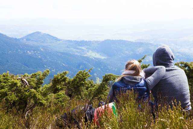
- Nature Study Walk: This is a circuit starting from Miyukigahara, up to the 750-800 meter altitude peak of Mt. Nantai. The observatory at the top of the course offers views of the Kanto Plain, and you can see all the way to the Tokyo Sky Tree and Mt. Fuji. If you use the cable car from Miyawaki Station next to Tsukubasan-jinja Shrine, you can shorten the climb to Miyukigahara from 90 minutes to a mere 10. This is the perfect way to enjoy Mt. Tsukuba's natural beauty, including a section of Japanese beech forest designated a Quasi-National Nature reserve.
- Course6
- Inter-Summit Walk: This hiking trail connects the summits of Mt. Nantai and Mt. Nyotai along the ridgeline. There are tea houses around the midpoint, on Miyukigahara, making this Mt. Tsukuba's most visited area. There are also events here, depending on the season. It's about 15 minutes from Miyukigahara to either summit, Mt. Nantai or Mt. Nyotai. This route is safe even for those with small children, so it's a nice way to enjoy Mt. Tsukuba's scenery. There aren't any areas that are particularly dangerous, but the trail near the summit of Mt. Nyotai is narrow, leading to foot traffic backing up and a minor danger of tumbling.
- Course7
- Back Trail Course: This route climbs Mt. Tsukuba's north face. This trail required a car, since there is no public transportation access to the trailhead. You enter the trail via the Tsukubakogen Camp Grounds, with its swathes of dogtooth violets. This trail's chief attraction is the long woodland passage. This means that there isn't much of a wide open view, and the snow usually doesn't melt until mid-March. When you leave the woods, you find yourself on flat ground just below the summit of Mt. Nyotai.
Information Sources: NAVITIME JAPAN
![Enjoy [Ibaraki, Ishioka] families or groups! Experience riding [30 minutes]](https://img.activityjapan.com/10/10325/10000001032501_AKMhwJ9H_4.jpg?version=1508246953)
![[Ibaraki, Ishioka] okay even for beginners! Forest road outside the power and venue ride [about 2 hours]](https://img.activityjapan.com/10/10327/10000001032701_msRSwrFV_4.jpg?version=1525851033)