Mountain Spots in Iwate Area
Area
-
-
Iwate


-
-
Iwate

Category
-
- Mt. Hachimantai Summit
- Travel / Tourism
- Iwate Hachimantai-shi
- Mt. Hachimantai sprawls almost equally in Hachimantai City, Iwate Prefecture and Akita Prefecture. Due to its rather un-mountain-like shape, in 1962 Iwate Prefecture added soil to the mountain to improve its look. The top of the mountain is a cool 15° C even in the middle of summer, Hachiman Swamp, the largest swamp in Hachimantai, is lush with Asian skunk cabbage, hare's-tail cottongrass, and other alpine plants. The beautiful clear blue waters of the Hachimantai Dragon Eye pond from which it gets its name can only be seen during the season of fresh green leaves in spring.

-
- Mt. Nansho
- Travel / Tourism
- Iwate Shiwa-gun Yahabacho Kemuyama
- This mountain is about a 20-minute drive from JR Yahaba Station, an 848-meter mountain on the border between the towns of Shizukuishi and Yahaba. With a symmetrical shape like a horizontal mirror, it is home to many species of animals and plants. It has been celebrated since ancient times as the home of Seiryu Daigongen, and “lion’s head” is offered on the mountain top for praying for rain. Author Miyazawa Kenji is known to have visited this mountain many times. The Nusakake Trail, which starts near Yahaba Hot Srping toward the fifth station of the mountain is the family-friendly, while other route is for more advanced climbers. The mountain is closed for the winter between December and April.

-
- Mt. Himekami
- Travel / Tourism
- Iwate Morioka-shi Tamayama
- This mountain is located in Himekami National Forest in Tamayama, Morioka City. Standing 1,124 meters high, it is part of the Sotoyama-Hayakawa Highland Prefectural Nature Park. The Shibutami District (the former Shibutani Village), west of the mountain, is known as the birthplace of poet Takuboku Ishikawa, whose poems “My Hometown Mountain” reflects his deep ties to the area.

-
- Mt. Goyo
- Travel / Tourism
- Iwate Ofunato-shi Hikoroichicho Kamaishi-shi Tonicho Kesen-gun
- This mountain straddles the cities of Ofunato and Kamaishi and the town of Sumita in Kesen County. At 1,351 meters, it is the tallest peak along the Sanriku Coast. It is a lush natural environment, with clumps of azaleas and rhododendrons and old growth conifer forests, and the summit offers a panoramic view of the Sanriku Coast.

-
- Mt. Oritsume
- Travel / Tourism
- Iwate Ninohe-shi Shiratori Kunohe-gun Karumaimachi Kunohe-gun Kunohemura
- This mountain, 862 meters, lies across the boundaries between Ninohe City, KarumaiTown and Kunohe Village, and it is part of Oritsume-Basenkyo Prefectural Nature Park. Its lush natural setting includes old-growth beech forests. Walking trails have been laid out in the park, and from the observation point at the summit, tourists can see a panorama of the surrounding mountains, the ocean, and the nighttime cityscape of Hachinohe.

-
- Mt. Chausu
- Travel / Tourism
- Iwate Hachimantai-shi
- This mountain is located along the HachimantaiAspite Line Road in Hachimantai City. Its summit, with an altitude of 1,578 meters, affords a panoramic view of Mt. Iwate, as well as Mt. Hayachine, Mt. Chokai, Mt. Akita-Komagatake, Mt. Gassan, Mt. Hakkoda, and other mountains inside and outside the prefecture.

-
- Mt. Kinkeizan
- Travel / Tourism
- Iwate Pref. Nishiwaigunhiraizumichou Hiraizumi Hanadate In the ground
- Mt. Kinkeizan is located almost exactly at the midpoint between Chusonji Temple and Motsuji Temple. Legend has it that a pair of golden chickens, a male and a female, are buried at the summit of the mountain to protect the town of Hiraizumi; hence the name of the mountain, which means “Golden Chicken Mountain.” This mountain is mentioned in “The Narrow Road to the Deep North,” the poetic travel diary of the 17th century haiku poet Matsuo Basho, and near the beginning of the climbing trail is a small memorial pagoda marking the graves of the wife and child of the 12th century warrior Minamoto no Yoshitsune.

-
- Mt. Hayachine
- Travel / Tourism
- Iwate prefecture Hanamaki City Osaki-cho, Tono-shi, Miyako-shi
- Mt. Hayachine stands where the boundaries of the cities of Hanamaki, Miyako, and Tono come together. With a height of 1,917 meters, it is one of the Three Mountains of Tono, along with Mt. Rokkoshi and Mt. Ishigami. Its surface is marked by numerous cliffs and rock outcroppings, and it is well known for the high-altitude plants that bloom in the spring. Its forested belt produces beautiful autumn leaves, and looking up at them from the foothills is a popular pastime. In 1982, it was designated a quasi-national park.

-
- Mitsuishi San
- Travel / Tourism
- Iwate Iwate-gun Shizukuishicho
-
- Mt.Junishin
- Travel / Tourism
- Iwate Miyako-shi Omoe
-
- Mt.Yakeishi
- Travel / Tourism
- Iwate
-
- Mt.Hikami
- Travel / Tourism
- Iwate
-
- Mt.Monomi
- Travel / Tourism
- Iwate
-
- Mt.Rokkoshi
- Travel / Tourism
- Iwate
-
- Mt.Kuromori
- Travel / Tourism
- Iwate
-
- Mt.Yakushi
- Travel / Tourism
- Iwate
-
- Mt.Azumane
- Travel / Tourism
- Iwate
-
- Mt.Aomatsuba
- Travel / Tourism
- Iwate
-
- Mt.Gaitakamori
- Travel / Tourism
- Iwate
-
- Mt.Sakainokami
- Travel / Tourism
- Iwate

Iwate Areas
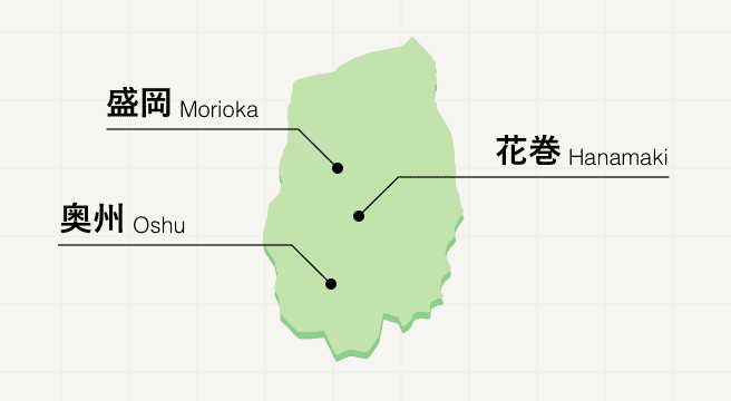
A northern Tohoku prefecture promising peace and quiet, Iwate is sparsely populated, replacing people with snow-capped mountains, history-rich sites, and fields of crops that are to thank for the region’s delicious local cuisine. Meander along the three-city Golden Route, where you’ll visit the grand Buddhist temples of Hiraizumi and the Tono folk villages before tasting the three famed noodle dishes of Morioka.
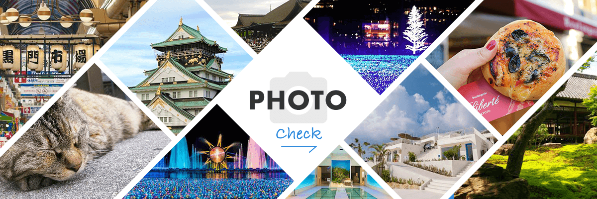
Iwate Photo Album
Best of Iwate
Search by Region
-
- Hokkaido / Tohoku
- Hokkaido
- Aomori
- Iwate
- Miyagi
- Akita
- Yamagata
- Fukushima
-
- Kanto
- Ibaraki
- Tochigi
- Gunma
- Saitama
- Chiba
- Tokyo
- Kanagawa
-
- Koshinetsu / Hokuriku
- Niigata
- Toyama
- Ishikawa
- Fukui
- Yamanashi
- Nagano
-
- Tokai
- Gifu
- Shizuoka
- Aichi
- Mie
-
- Kinki
- Shiga
- Kyoto
- Osaka
- Hyogo
- Nara
- Wakayama
-
- Chugoku
- Tottori
- Shimane
- Okayama
- Hiroshima
- Yamaguchi
-
- Shikoku
- Tokushima
- Kagawa
- Ehime
- Kochi
-
- Kyushu / Okinawa
- Fukuoka
- Saga
- Nagasaki
- Kumamoto
- Oita
- Miyazaki
- Kagoshima
- Okinawa


