Nature Spots in Japan
Area
-
-
Japan


-
-
Japan
Category

-
- Nushima
-
![rating-image]() 4.037 Reviews
4.037 Reviews - Travel / Tourism
- Hyogo Minami-awaji-shi Nushima
- The island is located about 4,600 meters south of Awaji Island in the northwestern part of the Kii Channel and is part of the Setonaikai National Park. There are spots associated with the myth, such as Onokoro Shrine, which enshrines Izanagi and Izanami, and Kami-tachigami Iwa, a 30-meter-high rock shaped like a halberd and said to be the "Pillar of Heaven.
-
![]()
淡路島の南方にある周囲9.53kmほどの勾玉形をした島。 淡路島の南方にある土生港から出てる沼島汽船で島に向かいました。 この島を訪れた目的は、ここが国産み神話においてイザナミ・イザナギの二神が天上の天浮橋に立って、天沼矛で青海原をかき回し、その矛を引き上げたところ、矛の先から滴り落ちる潮が凝り固まって一つの島となった「オノゴロ島」の伝承地の一つだからです。 日本中の神話の地をいろいろ訪問して...

-
- Mt. Nesugata (Shimoda Ropeway)
-
![rating-image]() 4.037 Reviews
4.037 Reviews - Travel / Tourism
- Shizuoka Shimoda-shi Higashihongo 1-3-2
- This is a mountain in Shimoda City. The mountain got its name from the ridge line at the crest which looks like the outline of a woman sleeping on her back. An aerial tramway near the IzukyuShimoda Station connects passengers to the peak of the mountain from which a panoramic view of downtown Izu, Mt. Amagi, and the seven islands of Izucan been seen.
-
![]()
short ride ropeway to the hill to enjoy the whole shimoda view. not very big but good place to visit

-
- Jogasaki Coast
- Travel / Tourism
- Shizuoka Pref. Itoushi Futo
- This coastal area southwest of Ito City, Shizuoka Prefecture was formed some 4,000 years ago when Mt. Omuro erupted and lava flowed into the ocean, after which the waves eroded the rock over many years, creating rough and precipitous cliffs. There is a nine kilometer long “Picnical Course” hiking trail following the peninsula renowned as a key sightseeing destination in Izu. Notable locations along the course include the thrilling 48 meter long, 23 meter high Kadowaki Suspension Bridge and the Kadowakisaki Lighthouse, which also has a viewing platform for visitors. In addition to offering beautiful views of the Seven Islands of Izu, the area is also a popular diving spot.

-
- Mt. Omuro
- Travel / Tourism
- Shizuoka Pref. Itoushi Futo
- This is a mountain of 580 meters above sea level in Ito City, Shizuoka Prefecture. There is a crater on the summit with a diameter of about 300 meters, and you can also enjoy walking around the circumference of the crater. The purpose of “Yamayaki” (burning the dead grass off a mountain) which has been done for more than 700 years was in order to obtain Japanese nutmeg which was formerly used as animal feed for livestock. Nowadays, it is done on the second Sunday in February every year, and many people visit for sightseeing. The mountain was designated as a Natural Monument of Japan in 2010.

-
- Shikoku Karst
- Travel / Tourism
- Ehime Prefecture/Kochi Prefecture
- Shikoku Karst is a scenic spot noted as being one of the three largest karsts (geological feature) in Japan. The karst stretches for about 25 kilometers east to west and sits at a height of 1,000 to 1,500 meters above sea level. The Shikoku Karst is also the source of the Shimanto River, said to be the last clear stream in Japan on account of there not being any dams on the river. The sight of the Tosa Red cows grazing on the land is both tranquil and beautiful.

-
- Kouri Island
- Travel / Tourism
- Okinawa Pref. Kunigamigunnakijinson Kouri
- Kouri Island is located north of the main island of Okinawa, Yagaji Island. It is surrounded by emerald green seas, with a circumference of about eight kilometers. In 2005, the Kouri Bridge opened to connect the island with Yagaji Island, becoming a remote island that could now be reached by car from the main island. There are old houses and fields of sugar cane on the island, and the original Okinawan landscape remains remarkably unchanged. From ancient times, it has been given the names, “Love Island” and “God’s Island”, so there are also a lot of couples who visit this island.

-
- Lake Akan
- Travel / Tourism
- Hokkaido Kushiroshi Akanchouakankonsen
- Located within Akan National Park, Lake Akan is the fifth largest freshwater lake in Hokkaido. Lake Akan is famous as the habitat of the Marimo alga and the Kokanee landlocked salmon, both of which have been designated as Special Natural Monuments. In winter, the entire lake freezes over, enabling people to enjoy winter activities and sports such as fishing for Japanese Pond Smelt through the ice-skating, etc.

-
- Mikuni Sunset Beach
-
![rating-image]() 4.036 Reviews
4.036 Reviews - Travel / Tourism
- Fukui Pref. Sakaishi Mikunichoushuku · U.S.
- Perfect for beach bathing, Mikuni Sunset Beach has good quality water, shallow and wide beaches, and is famous for its beautiful sunset over the ocean. The period from July 25 to August 10th is packed with tons of events, including the Mikuni Fireworks Festival, popular with families. You can rent swimming rings, beach umbrellas, and even boats at the beach stand.
-
![]()
A small stretch of beach in Mikuni, but well-maintained and kept relatively free of garbage compared to other beaches along the coast. Its very popular in summer, full of sunbathers, swimmers and...

-
- Lake Haruna
- Travel / Tourism
- Gunma Pref. Takasakishi Harunakomachi
- This lake is located on the western side of Mt. Haruna, one of the “Three Mountains of Jomo.” It is a crater lake formed by eruptions from Mt. Haruna, and it is at an altitude of approximately 1,100 meters. It is known for its gorgeous view of the central volcanic cone of Mt. Haruna, which is often called “Haruna Fuji,” and it features in many outdoor activities, including pleasure cruise tours, motor home camping, hill-climb races, and other leisure and sports events.

-
- Kino Matsushima
-
![rating-image]() 4.049 Reviews
4.049 Reviews - Travel / Tourism
- Wakayama Higashimuro-gun Nachikatsuuracho Katsuura
- The boarding location for this tour boat is located approximately a five-minute walk from the JR Kii-Katsuura Station. It visits the unusual rock formations scattered outside Katsuura Port. The name, Kinomatsushima, refers to the beauty of the location, which is comparable to that of Matsushima, one of the three most scenic spots in Japan. Customers can board two types of tour boat and visit around the unusual shaped islands such as the Camel rock which has the camel-like hump as the name suggests, the Lion Island with green bushes on the top which looks like mane of a lion , the Cave of Tsurushima Island, the Yamanari Island where Taira no Koremori is said to have drowned himself. The course of the tour boats may change depending on the season and weather.
-
![]()
I was snapping photos, hoping some came out while shooting into the sun, but the landscape was outstanding.

-
- Kusasenrigahama Beach
- Travel / Tourism
- Kusumoto-ken, Aso City, Kusaki-igahama
- A prairie located in the remains of a caldera at the foot of Mt. Eboshi, one of the five peaks of Mt. Aso. The location is known for its picturesque and idyllic scenery—horses and cows freely graze in the area against the backdrop of the mountain’s smoking middle peak. Considered one of the most representative sights in the Aso area, many people come here to enjoy the atmosphere.

-
- Ashura no Nagare (Kujuku Islands)
-
![rating-image]() 4.543 Reviews
4.543 Reviews - Travel / Tourism
- Aomori Towada-shi Okuse
- "Oirase Stream is one of the most picturesque areas in Towada-Hachimantai National Park. The area around the stream is famous for the beauty of both its new spring verdure and fall foliage. Making its way between boulders and forest and consisting of waterfalls, rapids, and calm stream, the 14 kilometer long stream extends from Nenokuchi on the shore of Lake Towada to Mt. Yakeyama, and the area known as Ashura no Nagare is said to be the most dynamic and beautiful portion of the stream of all. The various rocks and boulders dotting this part of the stream, known as the ""Kujukushima Islands,"" are also beautiful."
-
![]()
奥入瀬渓流では必見のポイントの1つです。写真撮影にも最適です。豪雨の影響で濁りが残っているとのお話でしたが、それでもかなりキレイでした。

-
- Lake Shojiko
- Travel / Tourism
- Yamanashi Prefecture Minamitsuru-gun Fuji Kawaguchiko Town
- Located at an elevation of 900 meters, Lake Shojiko Is the smallest of the Fuji Five Lakes at only 0.5 square kilometers, but its surface is such a beautiful clear blue that during the Meiji period, it was touted overseas as the Switzerland of East Asia. Due to the frequently occurring upside down reflection of Mt. Fuji in its waters and the fact that Mt. Fuji appears to be embracing the smaller Mt. Omuro, the sight is sometimes call Fuji hugging its child. This scene makes the lake a popular spot for photographers.

-
- Shinyabakei
-
![rating-image]() 4.044 Reviews
4.044 Reviews - Travel / Tourism
- Oita Nakatsu-shi Yabakei Machi Shinyaba Hoka
-
![]()
11月月末に紅葉を見に行ってきました。駐車場は無料で歩いて数百メートルのところに遊歩道があり見晴らし台へ行けます。が、自然を活用したコースで且つ、落ち葉があり足元が滑りやすく体力と足元に注意必要です。見晴らし台からの景色は最高に綺麗でした。

-
- Matengai Cliff
-
![rating-image]() 4.538 Reviews
4.538 Reviews - Travel / Tourism
- Shimane Pref. Okigunnishinoshimachou Uragou
- This sheer 250-meter cliff is part of the Kuniga Coast in the national park on Nishinoshima Island, part of the Oki Islands. The whole area, including the Matengai Cliff, has been designated a National Place of Scenic Beauty. The precipitous faces of these rough basalt coastal cliffs worn down by the movement of the sea look as though they were cut with a knife. The area has been chosen as one of Japan's top 100 sunset viewing spots. About two kilometers of boardwalk connect the Matengai Cliff and Kuniga Beach. It's not so far, but as there is also a 250-meter difference in elevation, getting there and back takes from 60 to 90 minutes.
-
![]()
Definitely need a car to access this incredible spot, or hiking for a day. But the surreal view is worth it, with the shining sea and gust of air. I felt out of Japan, out of Earth!

-
- Onnenai Boardwalk
-
![rating-image]() 4.540 Reviews
4.540 Reviews - Travel / Tourism
- Hokkaido Akan-gun Tsuruimura Onnenai Onnenai Visitor Center
- This is a wooden pathway that starts from the Onnenai Visitor Center at the western end of the Kushiro Wetlands. There is a two-kilometer barrier-free wooden boardwalk that allows you to stroll through the Kushiro Wetlands, observing the flora and fauna of the changing seasons. Also leading to the promenade of Kushiro Marsh Observatory, it is a very popular place to enjoy a gentle stroll. It takes approximately one hour to go around once. Depending on the season, you can enjoy seeing flowers such as bogbean, cotton grass and bog rosemary as you go around wetlands of reed, sedges and peat moss. In addition, you can see wild birds, and Heike fireflies from July to August.
-
![]()
Arriving just after daybreak the bridge was busy but people faded away. I counted approx 15 cranes you need decent binoculars or scope, as well as the cranes I saw a white tailed eagle, kingfisher...

-
- Himakajima Island
- Travel / Tourism
- Aichi Pref. Chitagunminamichitachou Himakajima
- This remote island is located in the Mikawa-wan Quasi-National Park, in Mikawa Bay, Minamichita-cho, Chita County, Aichi Prefecture. It is famous as an island of octopus and blowfish, where visitors can enjoy eating fresh seafood. In addition, every year from May to September, visitors can enjoy events such as dolphin petting and various other activities.

-
- Lake Tanukiko
- Travel / Tourism
- Shizuoka Pref. Fujinomiyashi Saori 634-1
- This lake to the west of Mt. Fuji in Inokashira, Fujinomiya City has a circumference of around four kilometers. Visitors can enjoy the seasonal scenery of the lake shore, which includes cherry blossoms and autumn foliage, as well as activities such as boating, camping, and Japanese crucian carp fishing. Because of Mt. Fuji's position due-east of the lake, the visitors may be able to catch a Double Diamond Fuji, which refers to when a sunrise directly over Mt. Fuji's peak is reflected on the lake's surface.

-
- Cape Kamui
- Travel / Tourism
- Hokkaido Shakotangunshakotanchou Kouzakichou
- Located at the northwestern tip of the Shakotan Peninsula, Cape Kamui has imposing cliffs that rise up 80 meters out of the Sea of Japan. From the car park at the foot of the Cape, visitors can walk up to the top of the cliffs along “Charenka’s Path” promenade, a distance of 770 meters. It takes around 20–30 minutes to complete the walk to the edge of the cliffs; visitors can enjoy marvelous views of the sea as they walk. At the cliff edge, there is a panoramic, 300-degree view of the sea horizon, giving a real sense of how the Earth is actually round, not flat. In early summer, the Hokkaido Daylilies are in bloom, which is a beautiful sight. Please note that opening hours of the gate at the entrance to the path up to the cliffs vary depending on the time of year.

-
- Lake Usui
-
![rating-image]() 3.546 Reviews
3.546 Reviews - Travel / Tourism
- Gunma Pref. Annakashi Matsuidamachisakamoto
- "Lake Usui is a man-made lake that was created when the confluence of the Nakao River and the Usui River was dammed by the construction of the Sakamoto Dam; it is located around 10 minutes' drive from Yokokawa Station on the JR Shinetsu Line. The lake is surrounded by state-owned forest, and presents a beautiful appearance at any time of year; it is particularly spectacular in autumn, when the autumn foliage of the surrounding trees is reflected in the Lake. There is a roughly 1.2 kilometer long footpath around the lake, which takes approximately 20 minutes to walk round. Lake Usui is situated part-way along the ""Apt Road,"" a hiking path that follows the route of a disused railway line. The bright red bridge that crosses the Lake was constructed as an arched bridge."
-
![]()
中山道より脇道のそれると湖畔の駐車場にたどり着く事出来ます。舗装された駐車場と整備されたトイレがあり、景色も良くドライブ中の休憩地としては最適だと思います。


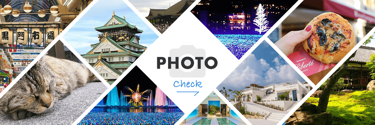
Search for Travel Information from Photographs
Search by Region
-
- Hokkaido / Tohoku
- Hokkaido
- Aomori
- Iwate
- Miyagi
- Akita
- Yamagata
- Fukushima
-
- Kanto
- Ibaraki
- Tochigi
- Gunma
- Saitama
- Chiba
- Tokyo
- Kanagawa
-
- Koshinetsu / Hokuriku
- Niigata
- Toyama
- Ishikawa
- Fukui
- Yamanashi
- Nagano
-
- Tokai
- Gifu
- Shizuoka
- Aichi
- Mie
-
- Kinki
- Shiga
- Kyoto
- Osaka
- Hyogo
- Nara
- Wakayama
-
- Chugoku
- Tottori
- Shimane
- Okayama
- Hiroshima
- Yamaguchi
-
- Shikoku
- Tokushima
- Kagawa
- Ehime
- Kochi
-
- Kyushu / Okinawa
- Fukuoka
- Saga
- Nagasaki
- Kumamoto
- Oita
- Miyazaki
- Kagoshima
- Okinawa


